For our first training and bonding weekend, the Oxus Expedition team headed north to the Lake District National Park, one of the wildest and most beautiful places in the UK.
Wastwater, Lake District
Lake District National Park
The Lake District National Park in Cumbria is home to England’s highest mountain, Scafell Pike (978m), and since 2017 it has been a UNESCO World Heritage Site. Alfred Wainwright — the most famous chronicler of Lake District walks — lists 214 fells (hills and mountains), and there are 16 lakes, if you include the waters and meres. It is undoubtedly one of the most scenic parts of the British Isles, and though Daniel Defoe once described the area as “the wildest, most barren and frightful of any that I have passed over in England,” it has been a popular tourist spot since the late 18th century. Towns such as Windermere and Kendal are busy in the summer months, but you never have to go far into the fells to find unspoilt views and a sense of peace.
We chose the Lake District for our pre-expedition training session because it offers some of the most varied and strenuous hiking in the UK. Yes, even Scafell Pike is a mini mountain compared to the soaring peaks of the Pamir and Hindu Kush, but as COVID-19 prevented us going further afield, we had limited options. And, in honesty, it was not such a hardship: the Lake District is stunning, there’s no risk of altitude sickness, and if you plan your route carefully you’ll be rewarded with a pub at the end of the day.
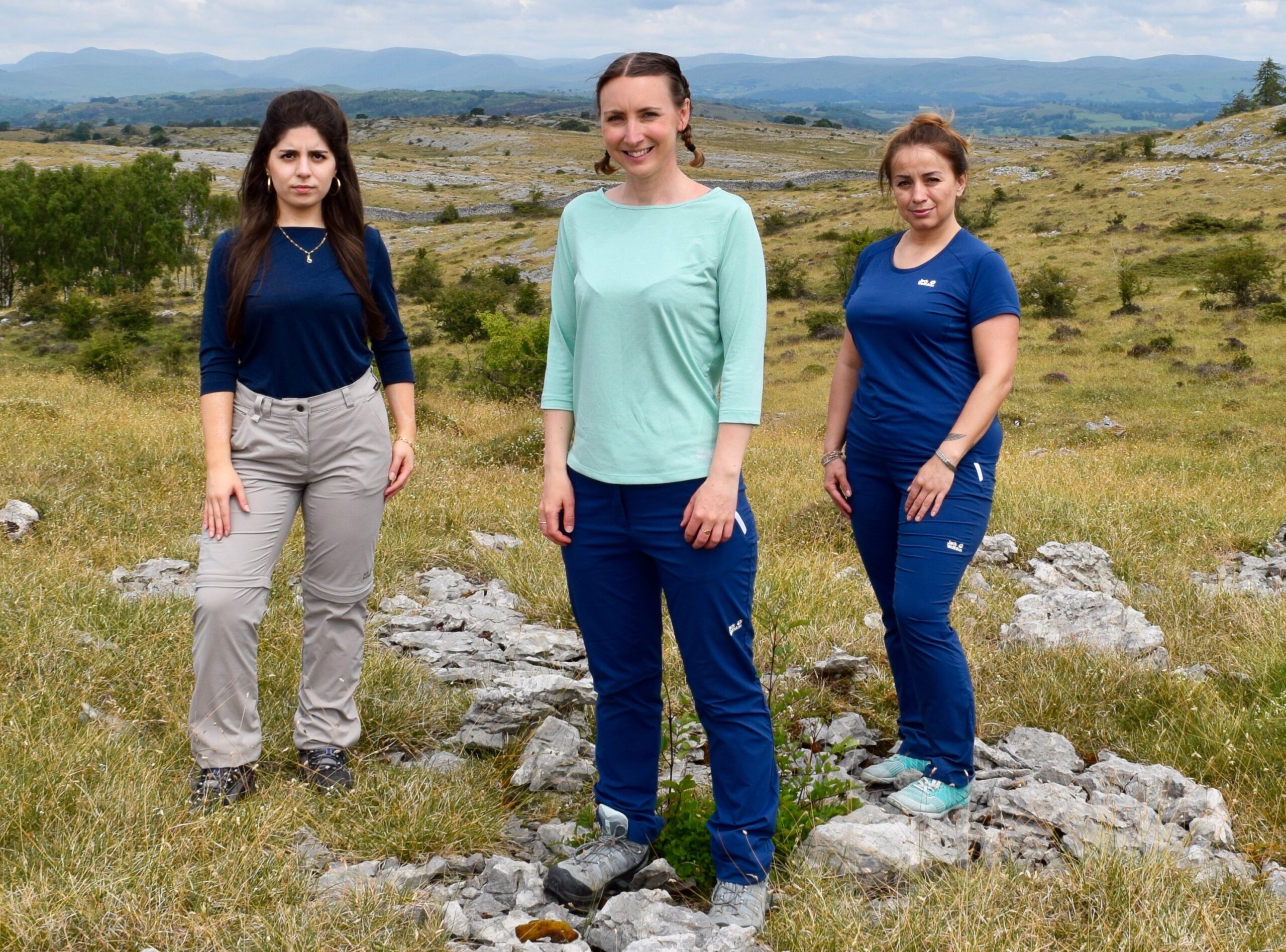
Although we had met once over lunch in London, this was the first occasion we’d spent any length of time together as a team. It’s always a bit nerve-racking getting to know new people, especially if you’ve already committed to spending months in each other’s company in challenging environments. During the trip we wanted to talk through some of the expedition’s more thorny subjects (COVID-19, closed borders, security, etc.) and make a call as to whether or not we should try and travel this year. Also on the list were testing out our delivery of clothing and camping equipment from official expedition sponsor Jack Wolfskin, building our fitness, and getting some photos we could use for promotional purposes.
Sophie Ibbotson
Miskola Abdulloeva
Sophia Burna-Asefi
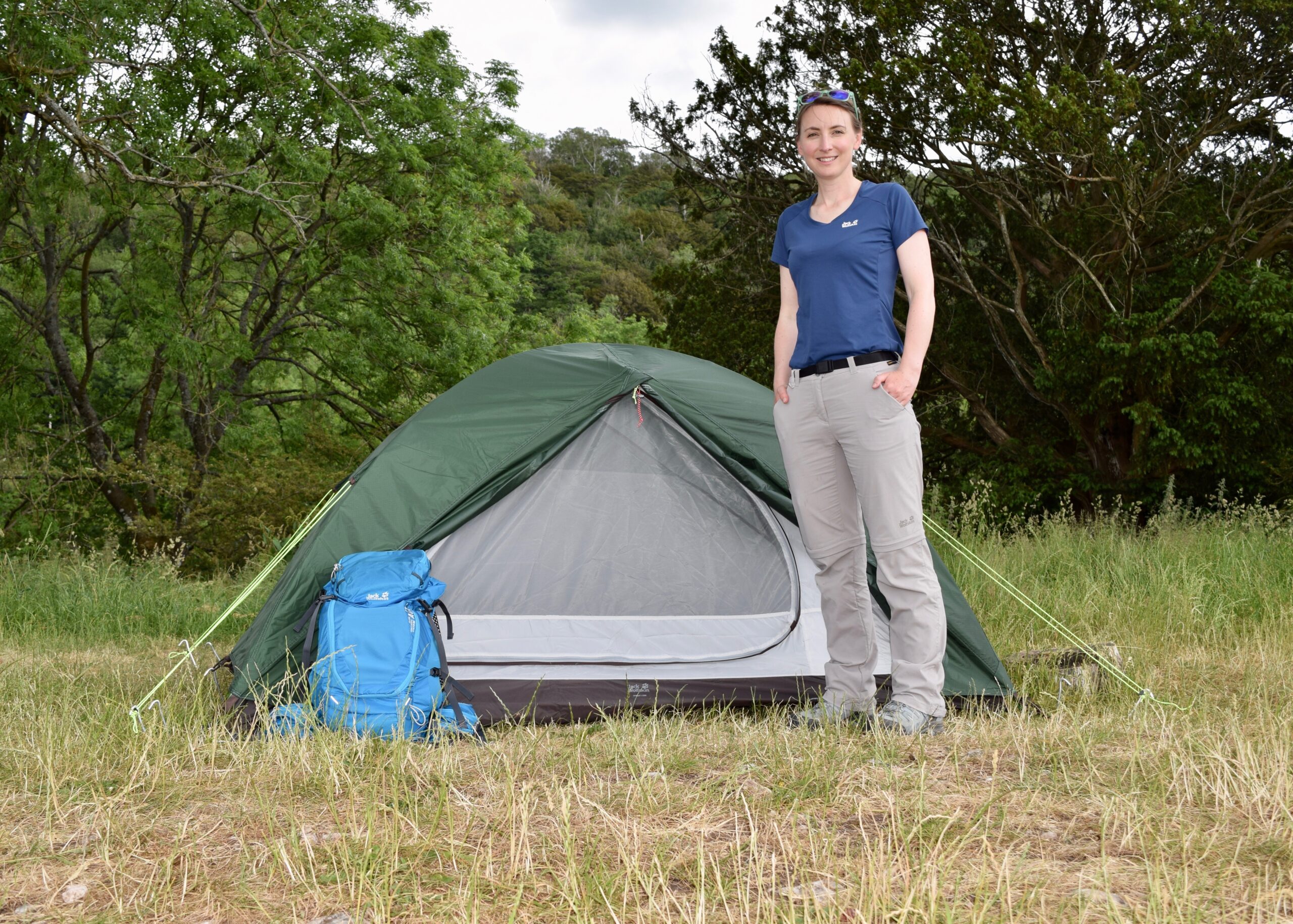
Although the park authorities usually turn a blind eye to wild camping in the Lake District, they prefer if you camp in a designated camping area, which is fair enough. We managed to get space to pitch our three tents on the very edge of Moss Howe Farm, and to Miskola’s delight there were yurts in the field next door! Central Asia had followed us all the way to Witherslack.
Due to COVID, it had been a while since any of us had been away, let alone spent a night under canvas. Thankfully, the instructions on our Skyrocket II Dome tents were easy to follow and the rain gods cut us some slack as we pitched them, in spite of the threatening clouds.
We have each got a two-person tent for the expedition. This might sound a little excessive, especially as they’re generously sized, but we are going to be sleeping in them a lot, and in all kinds of conditions. If you have had a tough day in the mountains, it makes a real difference if you can retreat to your own private place, with room around you to unpack and relax.
We are going to be reviewing all our kit — including the tents — on the expedition blog, but it will be towards the end of the trip once we have really put them through their paces. The first impressions are good, however: lightweight, well-designed. and quick to erect, even if you’re chatting and not giving the tent your full attention…
There are an almost infinite number of footpaths and bridleways you could walk in the Lake District. Not all of them are marked or easy to spot, however, so an OS map like The English Lakes – South Eastern area is indispensable. We also used the satellite image option on Google Maps now and then to make sure we were on the right track, though once we get to the Wakhan Corridor this won’t really be an option.
One of the most attractive routes we took was a 14.5 mile circuit from Moss Howe Farm which incorporated the Whitbarrow Nature Reserve. The limestone here is 350 million years old, and the rocky outcrops juxtapose with the blue moor grass. From the top of the scar you can see great distances, including across the sands of Morecambe Bay. The nature reserve is known for its orchids and fritillary butterflies, and in the late summer you can apparently hear the skylarks sing.
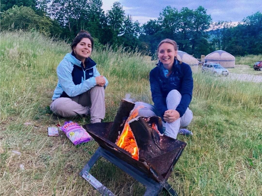
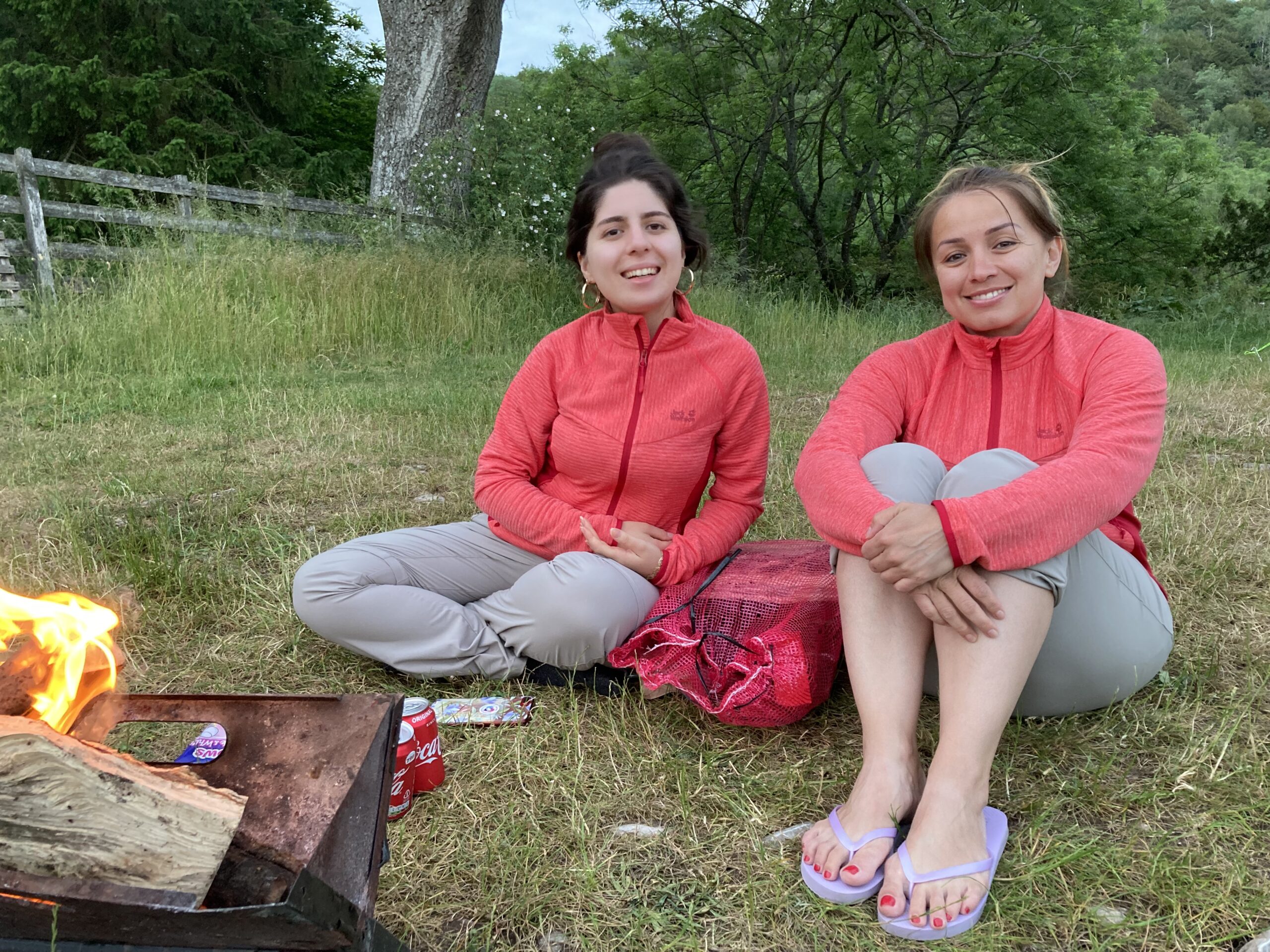
Sophia and Sophie
Sophia and Miskola
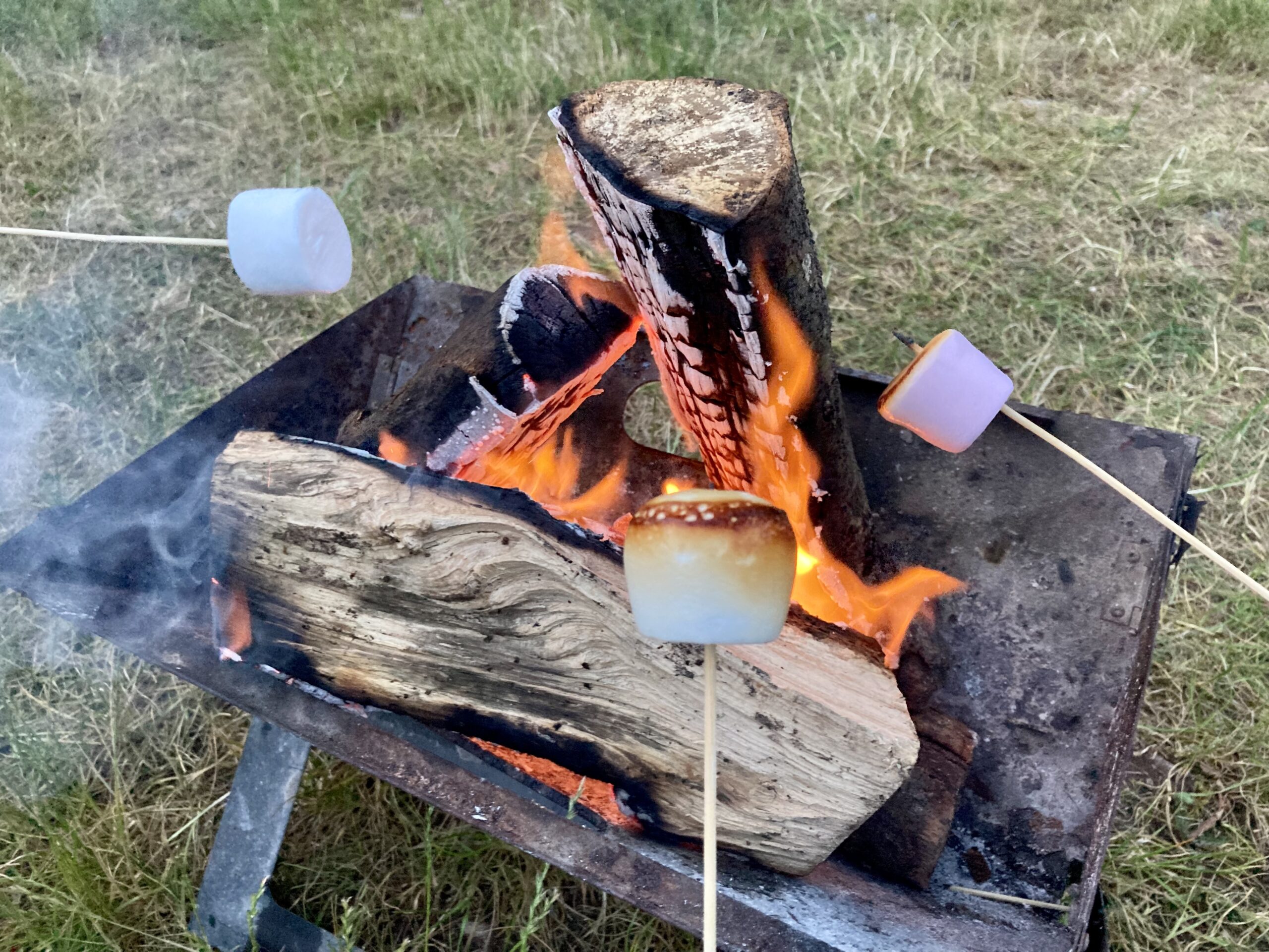
Marshmallows on the fire
Our attempts at cooking during the training expedition were rudimentary: bacon on the barbecue, and marshmallows over the fire. There were two reasons for this. Firstly, we don’t have our cooking equipment in the UK. We will be using Miskola’s multi-fuel stove and accessories, and collecting them when we arrive in Tajikistan. Airlines don’t tend to look too fondly on passengers flying with gas canisters or liquid fuels. Secondly, there are really good pubs (including The Derby Arms) close to Witherslack. We treated ourselves to classic pub grub like fish and chips and pies, washed down with local cider. This is exactly the kind of food that you feel like after a windswept day on the fells, and it is even more welcome when you haven’t had to cook it.
The Royal Society for Asian Affairs (RSAA) has a huge collection of historic maps, and Central Asia and the Pamirs are particularly well-represented thanks to the society’s links to the Great Game. Below are a few of the maps which include the Wakhan Corridor. You can find out more about the RSAA’s library and archives here.
Turkestan (1868)
Turkestan (1868)
1868: The earliest map of the Wakhan I’ve found so far in the RSAA archives is this one published by the Survey of India in 1868. The map is a hand-coloured photozincograph measuring 39 1/4″ x 54 1/2. The Wakhan Corridor is on sheet #2 in the series.
Of note is that the river is labelled as “Amu Daria Jihoon (Oxus)” and then “Punjah”, spellings which were later standardised as “Amu Darya” and “Panj”. The placing of these names on the map is strange, however, as the Panj doesn’t become the Amu Darya until after its confluence with the Vakhsh, some distance west of Kulyob (Kolab on this map). On this section of the map, therefore, we are only looking at the Panj, not the Amu Darya.
The full name of this map is Turkestan and the Countries Between the British and the Russian Dominions in Asia. It was prepared by James Thomas Walker (Surveyor General of India) and used survey data from both British and Russian officers. The map was published by the Survey of India in four sheets, and the Wakhan Corridor is on the southeast sheet. Unlike the 1868 map, the extent of the Panj is now property labelled.
Turkestan (1882)
Turkestan (1882)
Russian Turkestan (1885)
Russian Turkestan (1885)
Russian Turkestan (1885)
1885: Just as the Survey of India was producing maps for the British market, so too were their imperial counterparts in Russia. This very attractive colour map has a very large scale (1:4,200,00) but does still give some topographical details and shows the main course of the river.
Although this map was published in Russia, like many of the others in the RSAA’s collection it was purchased from Edward Stanford in Covent Garden. You can see the label on the cover. Stanfords, which was established in 1853, still exists and remains one of the best places in the world to buy maps and travel guides.
1896: Lord Curzon (later the Viceroy of India) travelled to Afghanistan and the Pamir in 1894, and finding the source of the Oxus was one of his key objectives. He did find a source — the ice cave at the top of the Wakhjir River — and he marks it confidently on this map, which was compiled under his direction and published in 1896. For this discovery, he was awarded a gold medal from the Royal Geographical Society.
This semi-colour map has a 1:100,000,000 scale and is backed on cloth. It measures 24″ x 24 1/2″ and is finely detailed, even showing some of the smaller rivers and settlements in the Wakhan. This map is important because it is the first to identify the Wakhjir as the Oxus’ source, a claim which we expect to disprove during the Oxus Expedition.
1901: Five years after Curzon’s map of the Pamir was published, France’s Army Geographical Serviced published their own map of the same region in French. It is likely that they used some of Curzon’s survey data, and perhaps also information from Gabriel Bonvalot’s expedition which took place a few years earlier.
The scale of this map (1:1,000,000) is the same as Curzon’s map. Every single village seems to be marked, and great attention has been paid to the naming of places, even if in some cases the spelling is a curious French-Persian hybrid.
This map measures 17 1/2″ x 21 1/2″. It is a semi-coloured heliographic print.
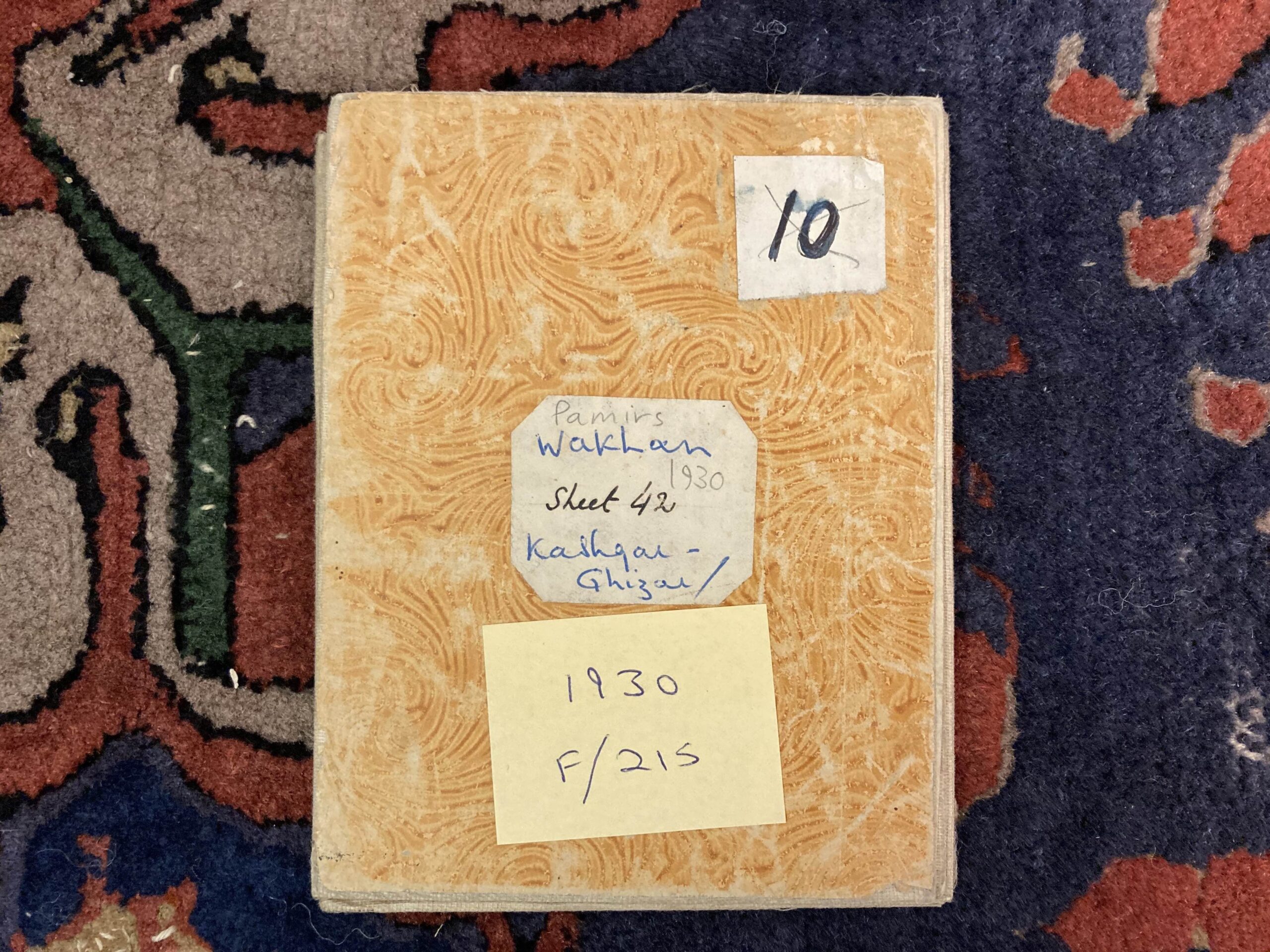
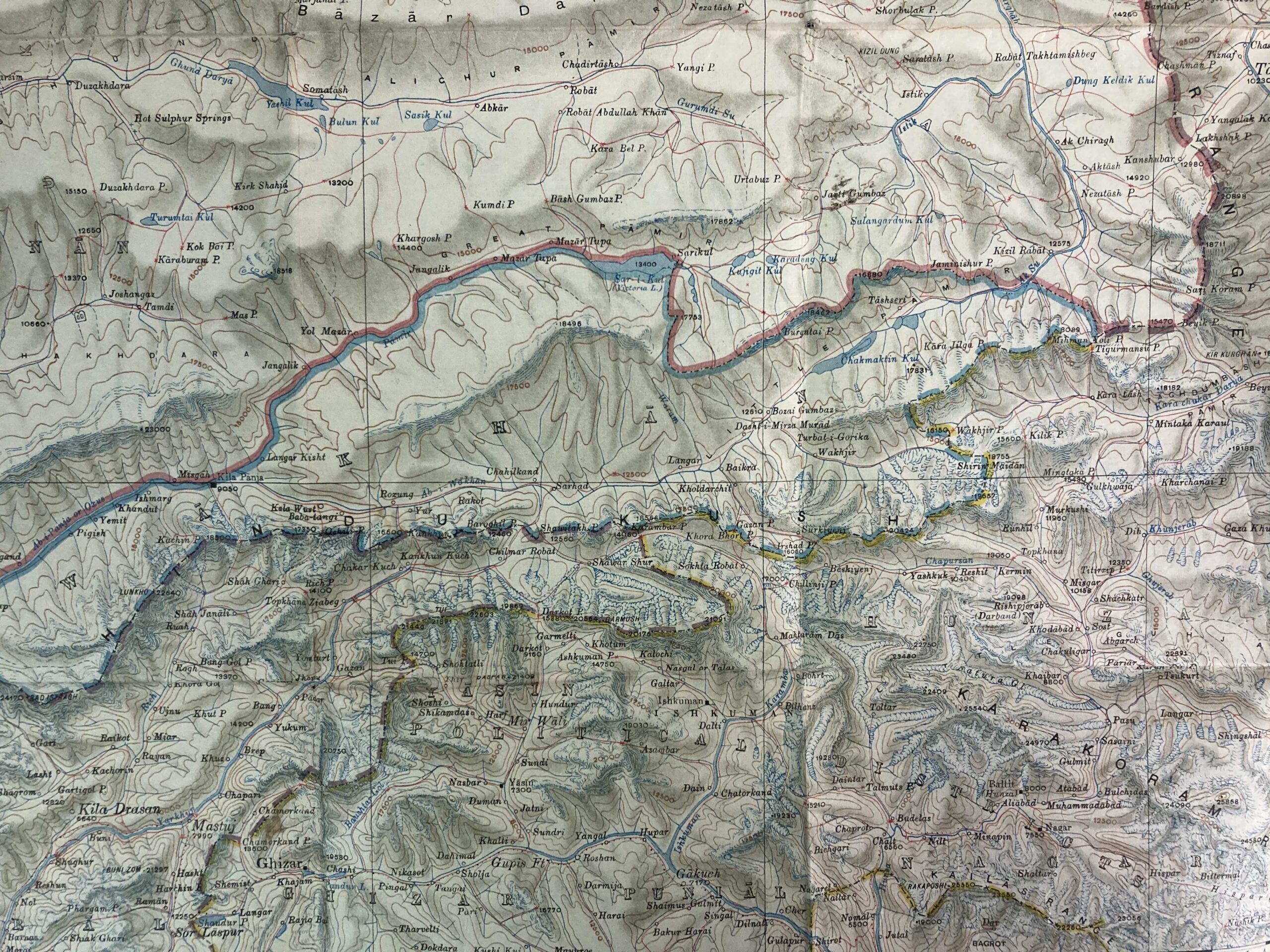
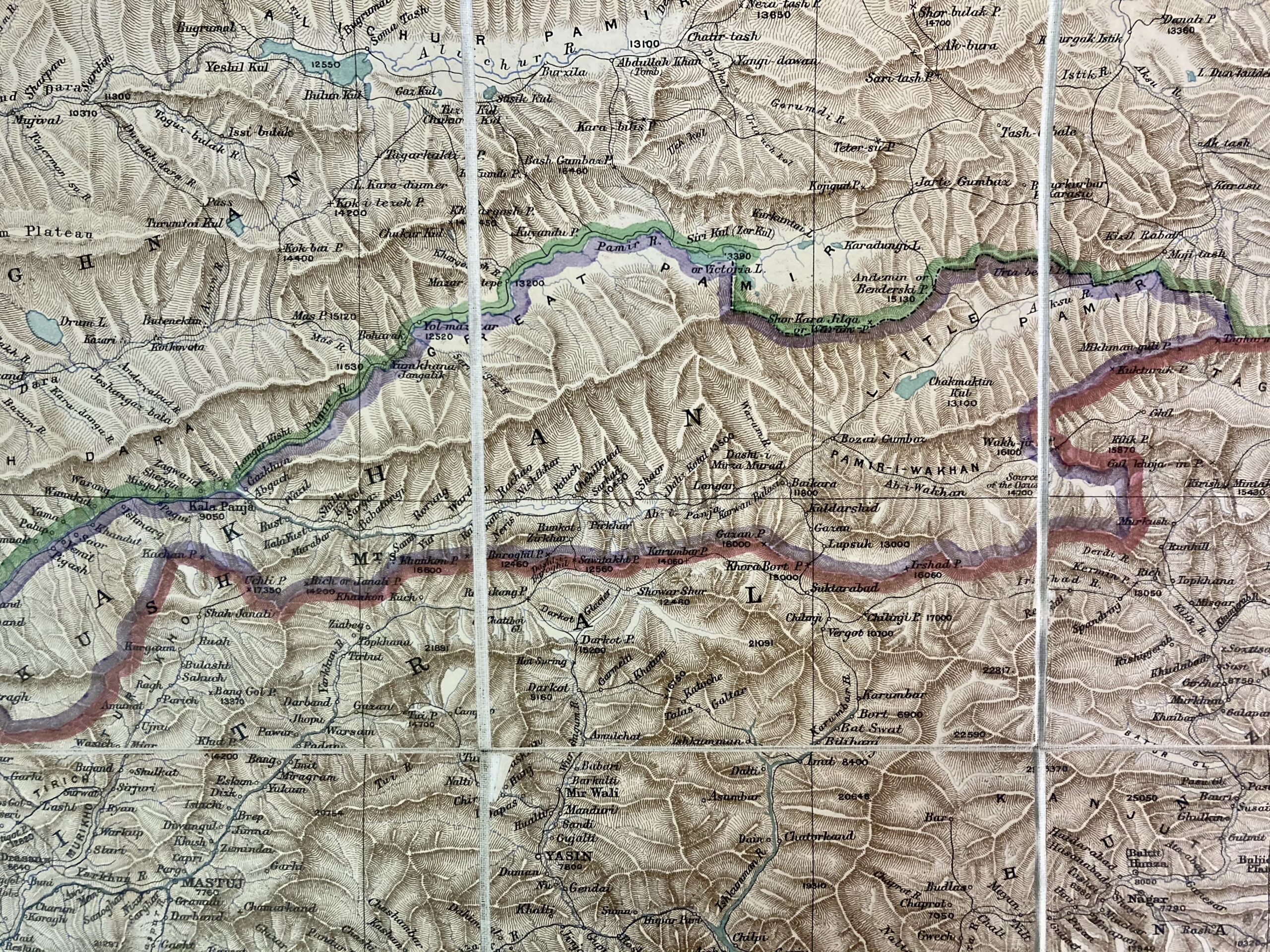
1930: By the 1930s, the Survey of India clearly thought it was about time that they publish another map of the Pamir, incorporating the knowledge obtained from expeditions in the early 20th century. As with previous maps, it has a scale of 1:1000,000 and was printed in semi-colour. This sheet (17 1/2″ x 14 1/4″) was number 12 in the series.
What is clearer on this map than on previous ones, in part because of the colouring, is the size and position of the various water resources. The extent of Lake Chaqmaqtin is much easier to see, for example, as are the huge number of glaciers around Curzon’s ice cave at the top of the Wakhjir Valley. You can see the confluences of the main rivers, too.
1941: The final Survey of India map of The Pamirs dates from 1941. Priorities shifted during WWII and in 1947 India gained its independence, so surveying and protecting “The Jewel in the Crown” was no longer on the agenda.
Unsurprising for a map made in the dying days of the British Empire, Zorkul is still marked as Lake Victoria. The Wakhan’s southern border with what became Pakistan is well-defined, but there is no demarcation of the corridor’s northern edge.
There are two copies of this map in the RSAA archives, one in better condition than the other. The map is sheet NJ 43 in a series, it measures 17 1/4″ x 21″, and is in semi-colour.
As the archive research aspect of the Oxus Expedition progresses, it is likely that I will find more maps of the Wakhan Corridor and I’ll be glad to share them with you then. I will write a separate blog about modern maps of the area, which in some cases are harder to find and less useful than their historic counterparts!
The Oxus Expedition was born in 2020 in London. Or was it? Arguably it has been more than 100 years in the making, and this is its latest incarnation. Either way, the Royal Society for Asian Affairs has a lot to answer for!
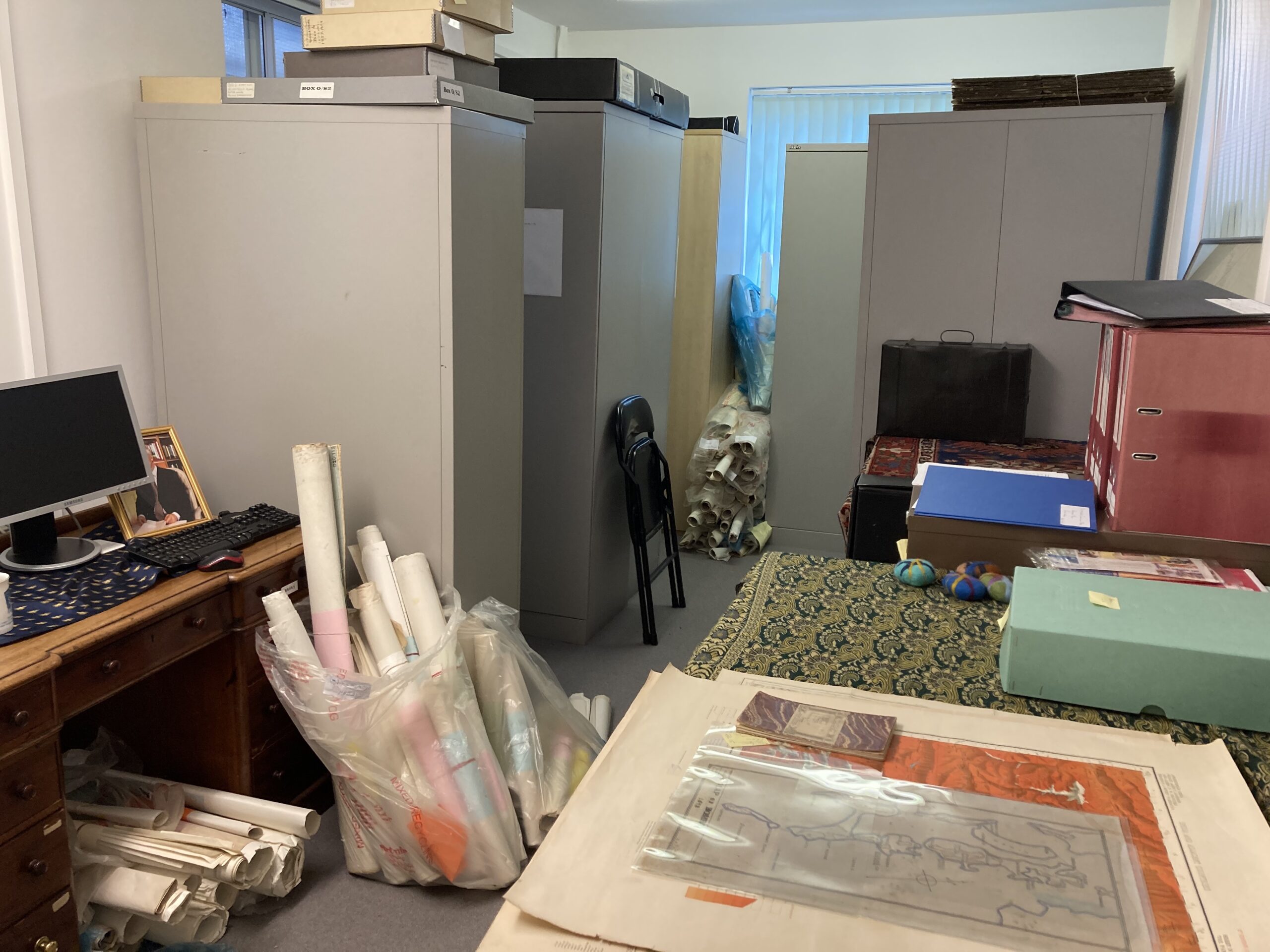
I call this “The Room of Requirement”. In fact, it is the archives of the Royal Society for Asian Affairs (RSAA). But just like its namesake at Hogwarts, it’s impossible to know exactly what is inside. You step through the door with a question, or a problem, and somewhere inside will be the solution. It could be a map, a photograph, a glass slide, or a hand written letter; or it could be a life-changing idea.
In January 2020, on a cold and miserable day, I went into the archives looking for early 20th century photographs of Tajikistan’s historical sites. At least that’s what I thought I was looking for. The Room of Requirement knew better. Instead, I left with an arm load of maps of the Wakhan Corridor and a copy of Lord Curzon’s The Pamirs and the Source of the Oxus. It was time to start preparing for the ultimate Oxus Expedition.
The RSAA was founded in 1901 as the Central Asian Society. It was at the height of “The Great Game” (or, as the Russians prefer to call it, “The Tournament of Shadows”) when the imperial British and Russian powers were competing for influence and territory in Central Asia. Afghanistan and what are now the five Central Asian republics — the ‘Stans — was their battleground.
But in the campaigns they led here, diplomacy and espionage were even more important than physical warfare. The heroes of the day were just as likely to be bureaucrats, geographers, and spies as they were to be military officers, though there were plenty of them as well. When they returned to London (or, in the Russians’ case, to Saint Petersburg), they wanted somewhere to meet like-minded people with shared experiences, to be able to discuss privately what could not yet be in the public domain, and to archive their materials for posterity. The Central Asian Society (which became the Royal Central Asian Society in 1931, and in 1975 changed its name to the RSAA) was founded by Dr Cotterell Tupp, Captain Francis Younghusband, Colonel Algernon Durand, and General Sir Thomas Gordon to meet this need. Lord Curzon was one of the earliest members.
Every major Great Game expedition and related geographical discovery was reported at an RSAA public lecture and recorded in the journal Asian Affairs. Hand-drawn and printed maps, letters and memoirs, sketches glass slides, and photographs were conserved for future use in the archives. The library grew and grew. And on the walls hung the great horns of a Marco Polo sheep, the emblem of the society. Most important of all were the materials linked to the source of the River Oxus in Afghanistan’s Wakhan Corridor, because that was the agreed frontier between the British and Russian Empires. It was these same materials I chanced upon in 2020, and from which I realised that the true source of the river was still to be proved.