The most commonly used definitions of a river’s source are the stream which begins furthest from the sea; and the stream which begins at highest altitude. A third definition refers to the volume of water that the stream contributes to the river system, and so in the Chelab we wanted to examine the four sub-streams (A-D) which come together, and to establish which of those was the principle.
There are plenty of ways to calculate the volume of water in a stream, but we needed something which was simple to use, affordable, reliable, and wouldn’t cause consternation amongst customs officials or anyone else searching our baggage. In summer 2024 we’d trialled the trans velocity head rod (TVHR) in the UK and found it worked well in test conditions. But a quiet chalk stream running through Wilton is not the same thing as a glacial mountain stream. How would it fare? We’re delighted to say, it worked well.
Glacial streams vary significantly in volume over the course of a day, as the warmth of the sun melts the ice, increasing the water flow. For this reason, we needed to undertake the stream gauging at approximately the same time for each river, conducting the work over several days to allow for the time required to walk or ride between the measuring sites. Working earlier in the day, when the water volume was lower, would also be safer, so we took all the measurements between 09.00 and 10.30.
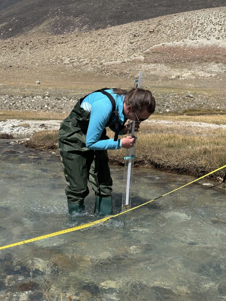
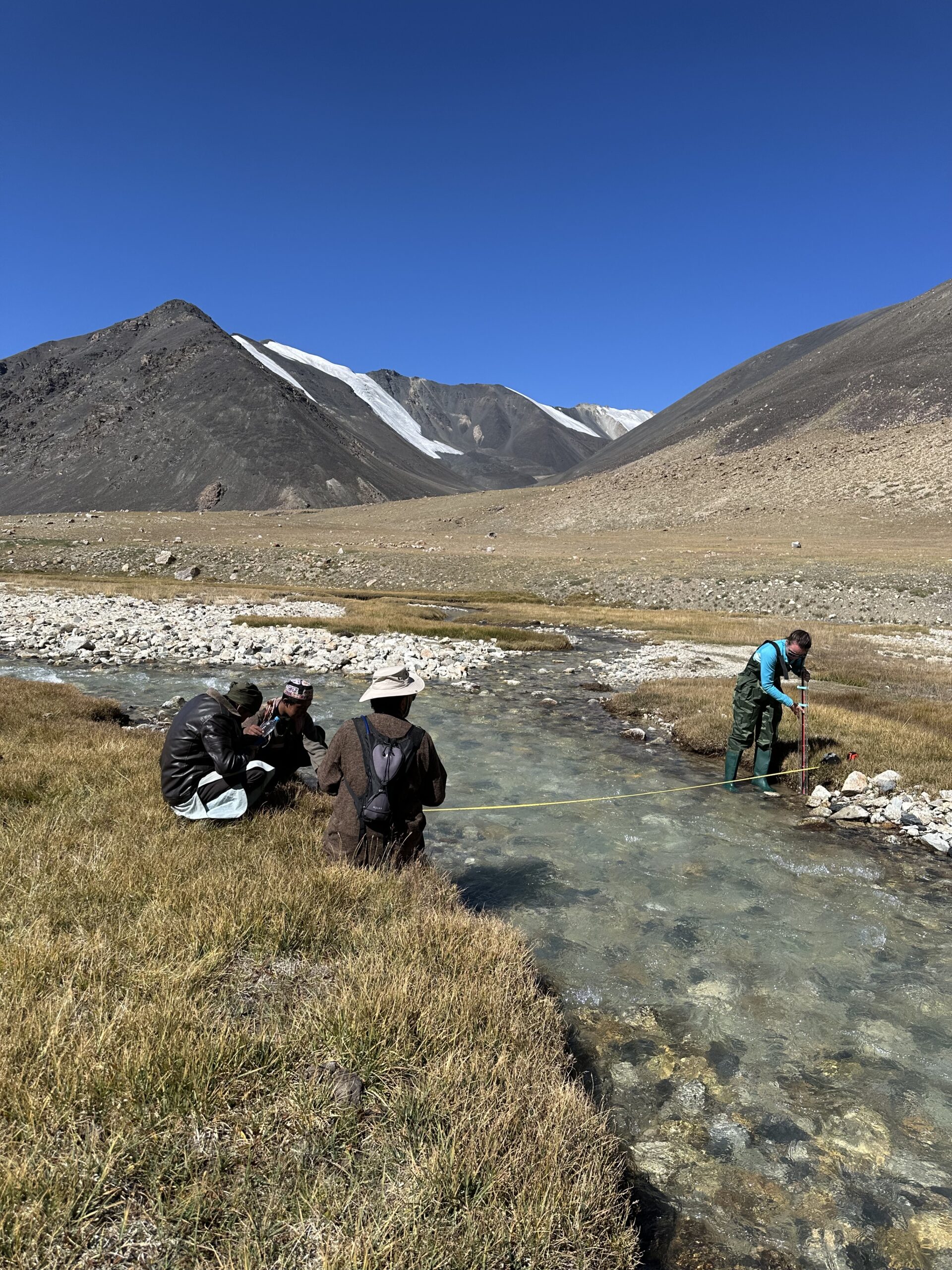
To start the process, we stretched a tape measure across each stream, from the left bank to the right. Sophie was in the water, wearing waders; and Mahmud Omar gamely kept the other end of the measuring tape in place. This gave us this width of the stream and meant we could easily see where each vertical measurement point — 20 cm apart — would be.
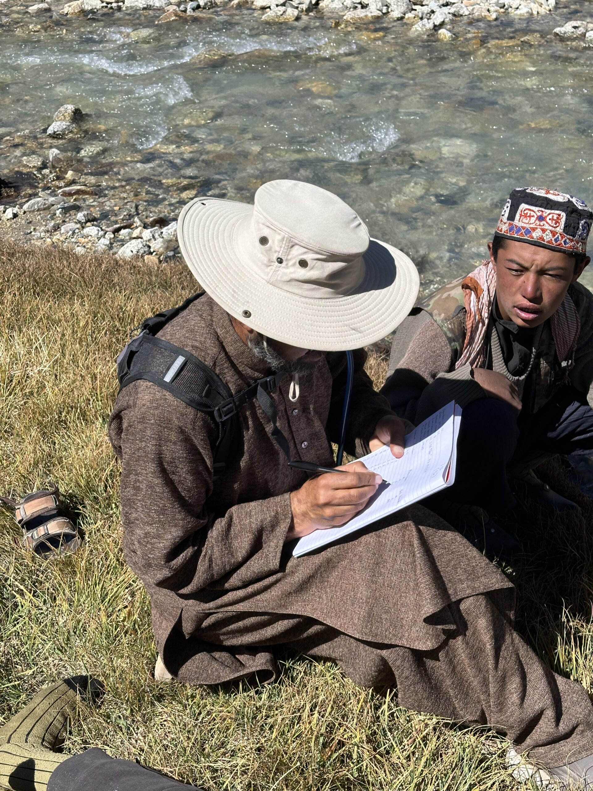
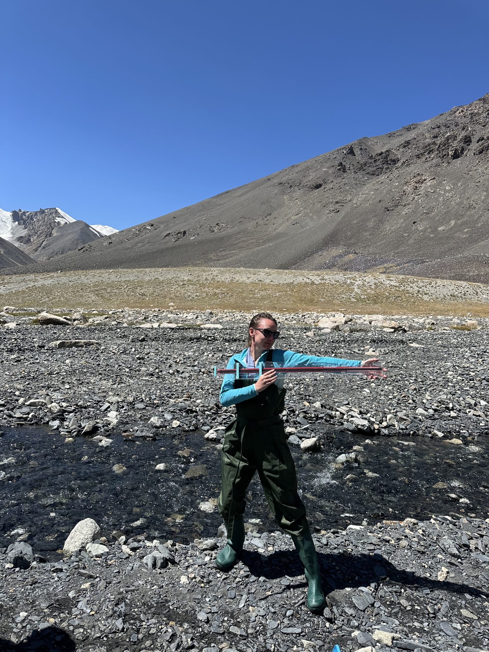
The TVHR is essentially a metre-long ruler made of perspex. You place it in the water vertically, side on to the flow, and raise the end of the clear gauge to the water’s surface to read the depth in centimetres. Then, you rotate the rod 90 degrees so the force of the water pushes against its flat side: there is a clear difference now between the water level on the upstream and downstream side of the rod. You slide the red gauge up to match the upstream water level, and then read off the velocity head in millimetres. Our guide, Salahuddin Esmaeli, recorded the data in a table, and we repeated the process again and again across each stream’s width, collecting all the information required to calculate the cross-section of the stream and the volume of water flowing through it.
TVHR’s inventors, INRAE, provide a spreadsheet for the calculations. Without electricity in the Chelab Valley and not wanting to risk a laptop in the harsh environment, we inputted the data later. These are the results for the four streams
A = 0.535 cumecs (535 litres/sec)
B = 0.136 cumecs (136 litres/sec)
C = 0.114 cumecs (114 litres/sec)
D = 0.490 cumecs (490 litres/sec)
Individually, A is the largest of the four streams which together comprise the Chelab. However, the other three streams have already merged upstream, so the confluence is not of A and D, but of A and the by now larger B-D stream, as the latter already holds the total volume of three streams’ flow within its course. As the mainstem of a river is the larger (by volume) of the two tributaries joining at a confluence, the mainstem of the Chelab is as follows:
A / B-D confluence: mainstem = B-D
B / C-D confluence: mainstem = C-D
C / D confluence: mainstem = D.